Monthly Archives: April 2016

A big thank you for supporting Ecuador

Last evening students and researchers of the GIScience group and the Geographical Institute, members of the OSM community and Open Data supporters gathered to support the Ecuador activation of the Humanitarian OpenStreetMap team (HOT).

In response to the severe earthquake last Saturday, the HOT team had launched several mapping projects to enable the creation of a base map of the affected regions. These projects have then been complemented through post-disaster tasks in which the level of destruction is assessed to help to coordinate the relief efforts. We wanted to support these efforts in a mapping event at our institute.

The event started with a short introduction in which the disastermappers provided background information about the activation and mapping itself. Then the 30 participants started to become active themselves in the mapping projects.
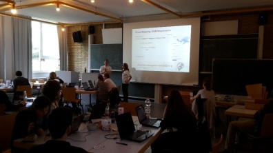
intro

A group of experienced mappers gathered information about damaged roads and bridges using post-event imagery. This data is needed to enable emergency routing e.g. via the direct use within the OpenRouteService Ecuador.

The other participants gathered information about the road network, building structures and residential areas in the affected area to provide information about possibly affected settlements and access routes.

In only 3 hours a whole task was finalized covering one of the most affected regions. The detailed map material can be directly utilized now for relief operations on the ground.

result

A big thank you to all participants of our Ecuador mapping event by your disastermappers and the HOT Ecuador team!

Mapping Event to support relief efforts in Ecuador

Last Saturday Ecuador was hit by a devastating earthquake that caused a lot of casualties and destruction. With no current map material available relief efforts turned out challenging.

We want to support the Humanitarian OpenStreetMap team activation for Ecuador with a Mapping Event at the Geographical Institute at Heidelberg University.

In the event you will get the chance to collect OpenStreetMap data of the affected region and to thereby support the local population and the humanitarian organizations on the ground.

If you are interested in becoming active please join us in the Hörsaal in Berliner Straße 48 from 6 pm.

No previous knowledge or tools needed. We will start with a small mapping introduction and will be there to assist and answer questions.Only bring your own laptop and mouse if available.

Drinks and snacks will for sure be provided 🙂

Very looking forward,

disastermappers heidelberg


disastermappers heidelberg and GIScience meeting Missing Maps in London to foster collaboration and partnership

Last week, Carolin Klonner, Benjamin Herfort, Melanie Eckle (GIScience Heidelberg and disastermappers heidelberg), Svend-Jonas Schelhorn, Christof Nichterlein (disastermappers heidelberg), Prof. Dr. João Porto de Albuquerque (GIScience Heidelberg and Centre for Interdisciplinary Methodologies, University of Warwick) and Roberto Rocha (University of Münster) travelled to London to meet the Missing Maps team.

During a one and a half day intensive creative workshop with the Missing Maps team, members of Médecines Sans Frontiéres UK and the British Red Cross insights of the work of each partner were given.

CfMnrHAWsAAfqWW.jpg large
Meeting with Missing Maps team (https://twitter.com/dekstop/status/716960412210753536)

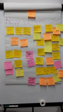
A brainstorming session facilitated the identification of core tasks and possible contributions of the workshop participants.

brainstorming


On the following day, the team was invited to the British Red Cross to learn more about the practices and projects of the BRC and how their work is supported by the Missing Maps project. The discussions showed that geodata quality is crucial when estimating population distribution or planning vaccination campaigns. The knowledge and work of the GIScience research group on crowdsourcing and VGI in general and OpenStreetMap data quality in particular can be very valuable in this context. The meetings were complemented with the monthly Missing Maps mapathon – one of the large scale mapathons organized by Missing Maps in varying venues all over London with about 80 participants.

mapathon-300x169
Mapathon (https://twitter.com/Disastermappers/status/717418900305084416

We learned how to handle mapathons with a large number of participants and gathered new ideas for own mapathons in Heidelberg. Moreover, the event provided a chance to present our work and research to the wider Missing Maps community and the present members of the Humanitarian OpenStreetMap team.

To further support the Missing Maps project we are open minded to support related bachelor or master theses. Furthermore, there will be several courses at the GIScience department in the coming semester dealing with topics also linked to the Missing Maps project.

Latest research concerning Missing Maps and humanitarian mapping from the GIScience research group include:

Anhorn, J., Herfort, B., Albuquerque, J. P., (2016): Crowdsourced Validation and Updating of Dynamic OSM Features: A Nepal Earthquake Case Study. 13th International Conference on Information Systems for Crisis Response and Management. ISCRAM 2016. Rio de Janeiro, Brazil.

Herfort, B., Eckle, M., Albuquerque, J. P., (2016): Being specific about geographic information crowdsourcing: a typology and analysis of the Missing Maps project in South Kivu. 13th International Conference on Information Systems for Crisis Response and Management. ISCRAM 2016. Rio de Janeiro, Brazil.